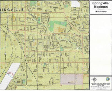
 Springville, Utah Historic Sites
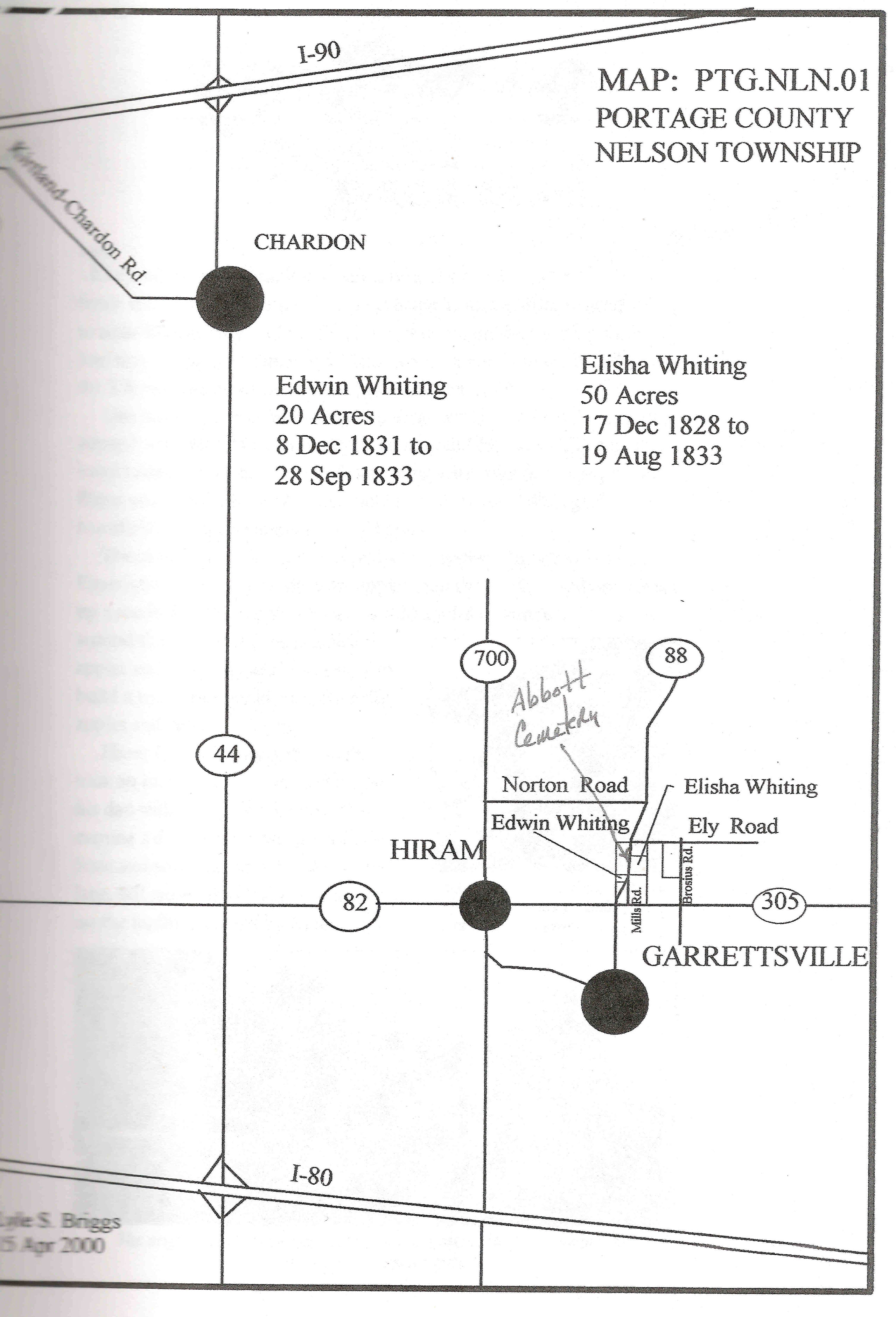
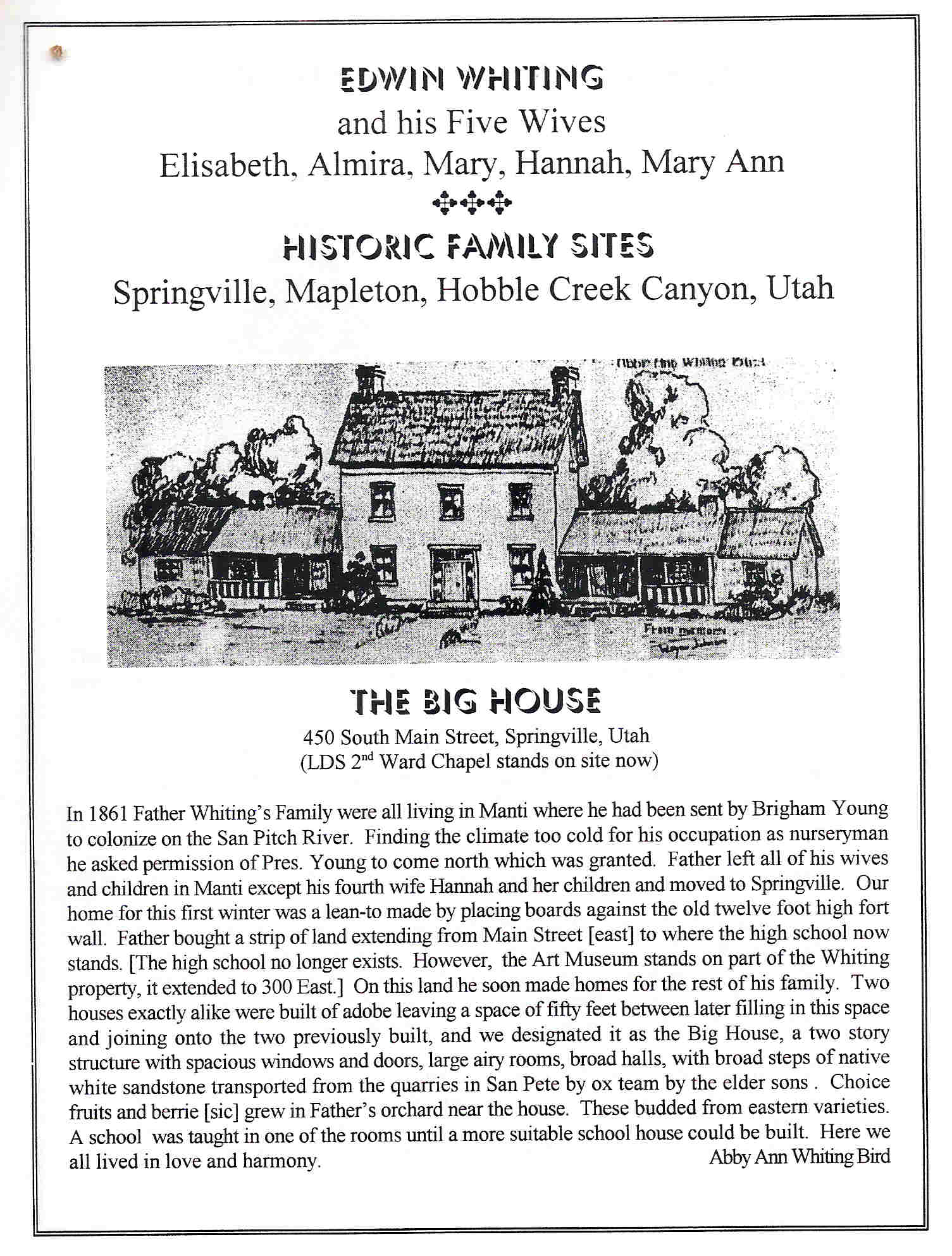
Edwin arrived in Springville, Utah County, Utah in 1861 along with his wife, Hannah and her children. Other family members remained behind in Manti until homes were constructed. During the first winter, Edwin, Hannah, and their children, lived in a lean-to that was made by placing boards against the 12-foot high wall of the Springville Fort. Edwin later secured property near Main Street and 400 South in Springville and built two identical homes out of adobe with a fifty foot space in between. A third structure was eventually constructed between the two smaller homes, and the completed home became known as the “Big House.” Edwin was active in community life in Springville. This page details some of the important historic locations within the city limits. Other nearby historical sites are located in Mapleton and Hobble Creek Canyon, and driving tours of all three areas are included on this site.
Self Driving Tour – Historic Sites
The self-driving Tour of Springville Historic Sites includes four stops:
- The Springville City Cemetery
- The site where the “Big House,” the red juniper heritage tree, and the “Little Red Schoolhouse”
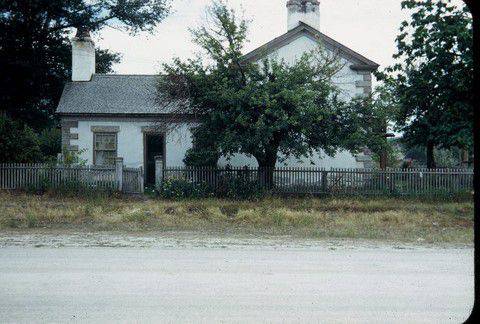
- The location of the Mary Ann Washburn home
- The Springville Evergreen Cemetery
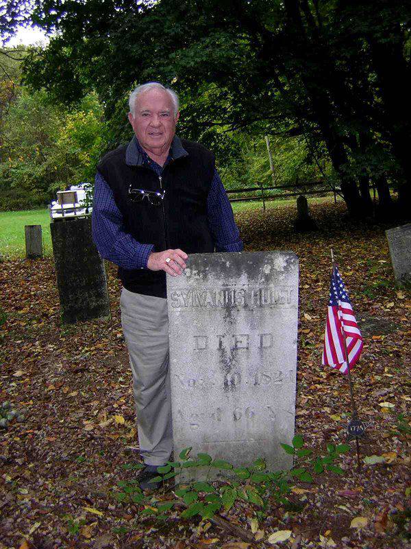
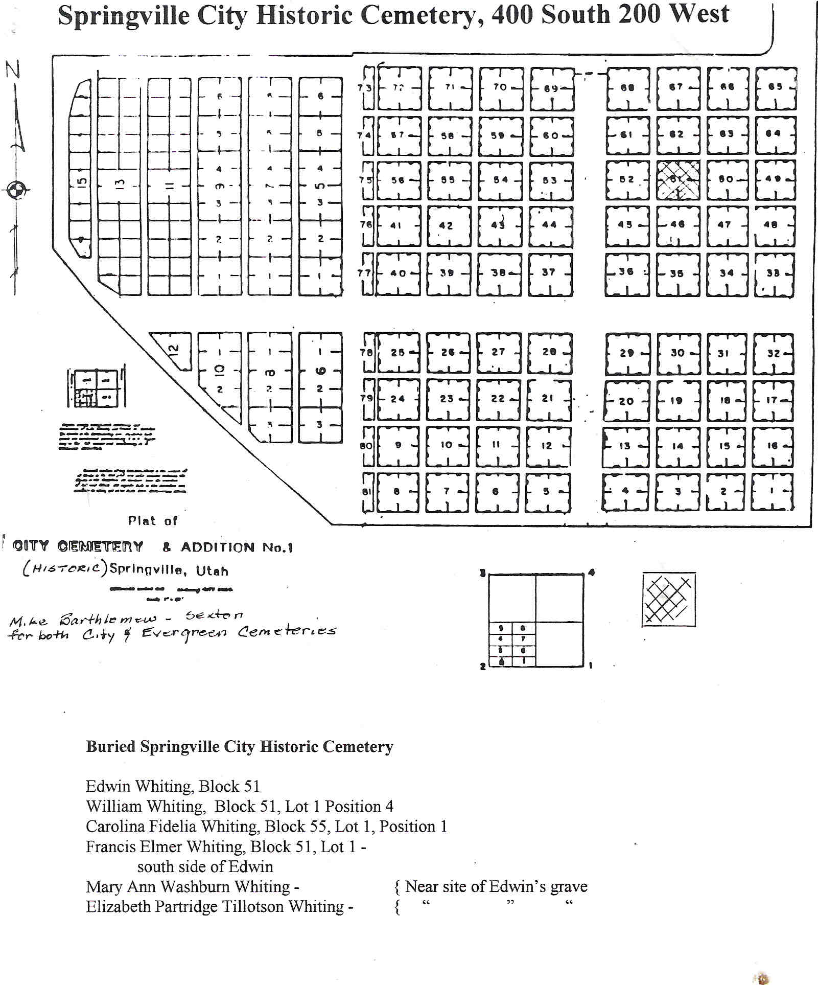
Stop 1: Springville City Cemetery
STOP 1· The beginning of the Self Driving Tour to visit some of the Historic Sites of Edwin Whiting and his family in Springville, Utah starts at the I-15 Exit 260, which is on the southwest side of Springville. Driving east to Springville (also known as the “Art City”) from this exit you will be traveling on Springville’s 400 South. Locals will also refer to it as 4th South. Travel east until you reach the Springville City Cemetery on 200 West. Other sites that follow are in a continuous route as much as possible.
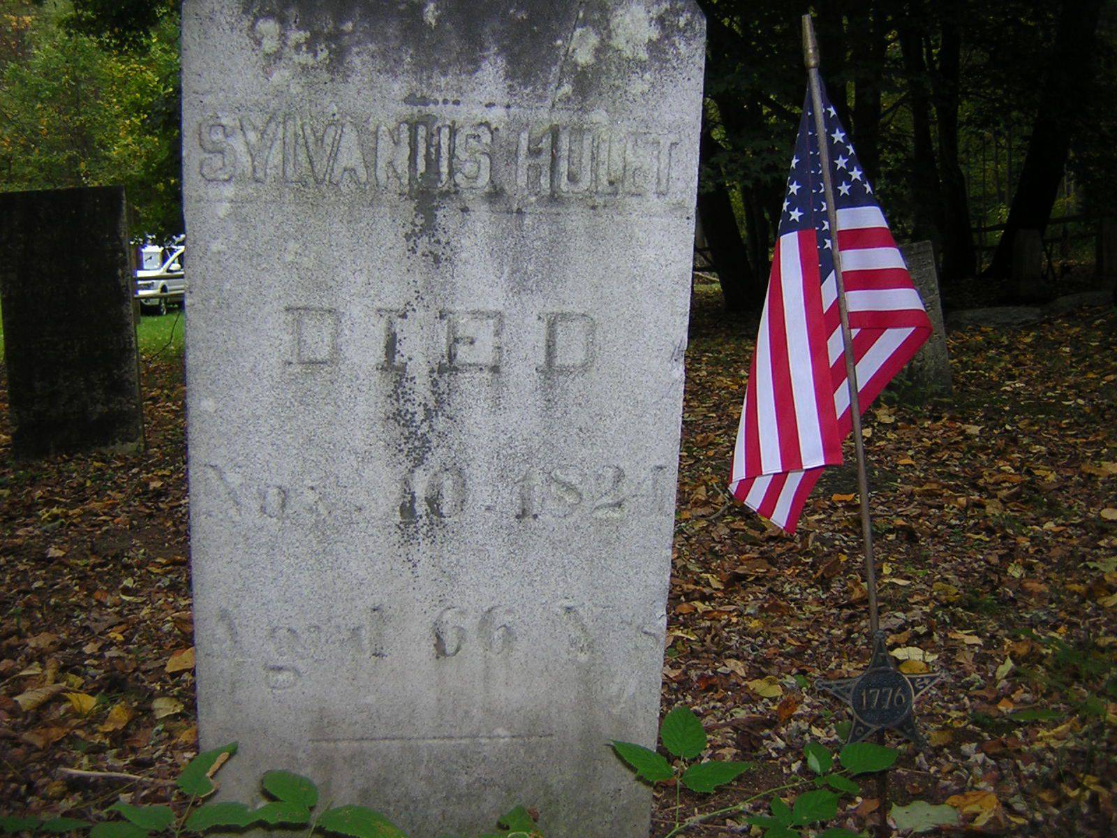
The following Edwin Whiting family members buried here are:
- Edwin Whiting – Blk 51 Lot 1 Pos. 8
- Elizabeth Partridge Tillotson Whiting – Blk 51 Lot 1 Pos. 7
- Mary Ann Washburn Noble Whiting -· Blk 51 Lot 1 Pos. 6
On the opposite side of Edwin’s headstone, you will find memorials to two of his wives, who are both buried here as well: Elizabeth Partridge Tillotson, Edwin’s 1st wife and Mary Ann Washburn Noble Whiting, his 5th wife. It is unclear why the spelling of Elizabeth Tilotson’s name is different on the headstone than it is in all other family records.
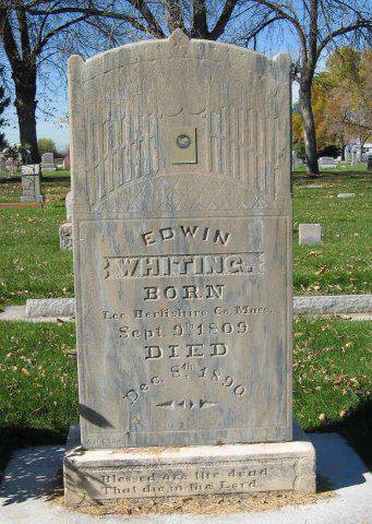
Headstone of Edwin Whiting is facing East
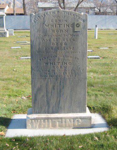
Headstone of Eliazbeth P, Tillotson Whiting and Mary Ann Washburn Noble Whiting.
It is on opposite side of Edwin Whiting headstone and faces west.
Other family members buried nearby include:
Francis Elmer Whiting, infant son of Edwin and Hannah – Block 51Lot 1 Pos 1, south side of Edwin
William Whiting – Block 51Lot 1 Pos. 4
Rebecca Losse Whiting – Blk 51 Lot 1 Pos 3
Carolina Fidella Whiting – Block 55 Lot 1 Pos. 1
Other names can be searched by going to www.springville.org/cemeteries
Stop 2: Location of the “Big House”
This sketch, drawn by Wayne Johnson represents the “Big House which was located at approximately 435 South Main Street in Springville, Utah.
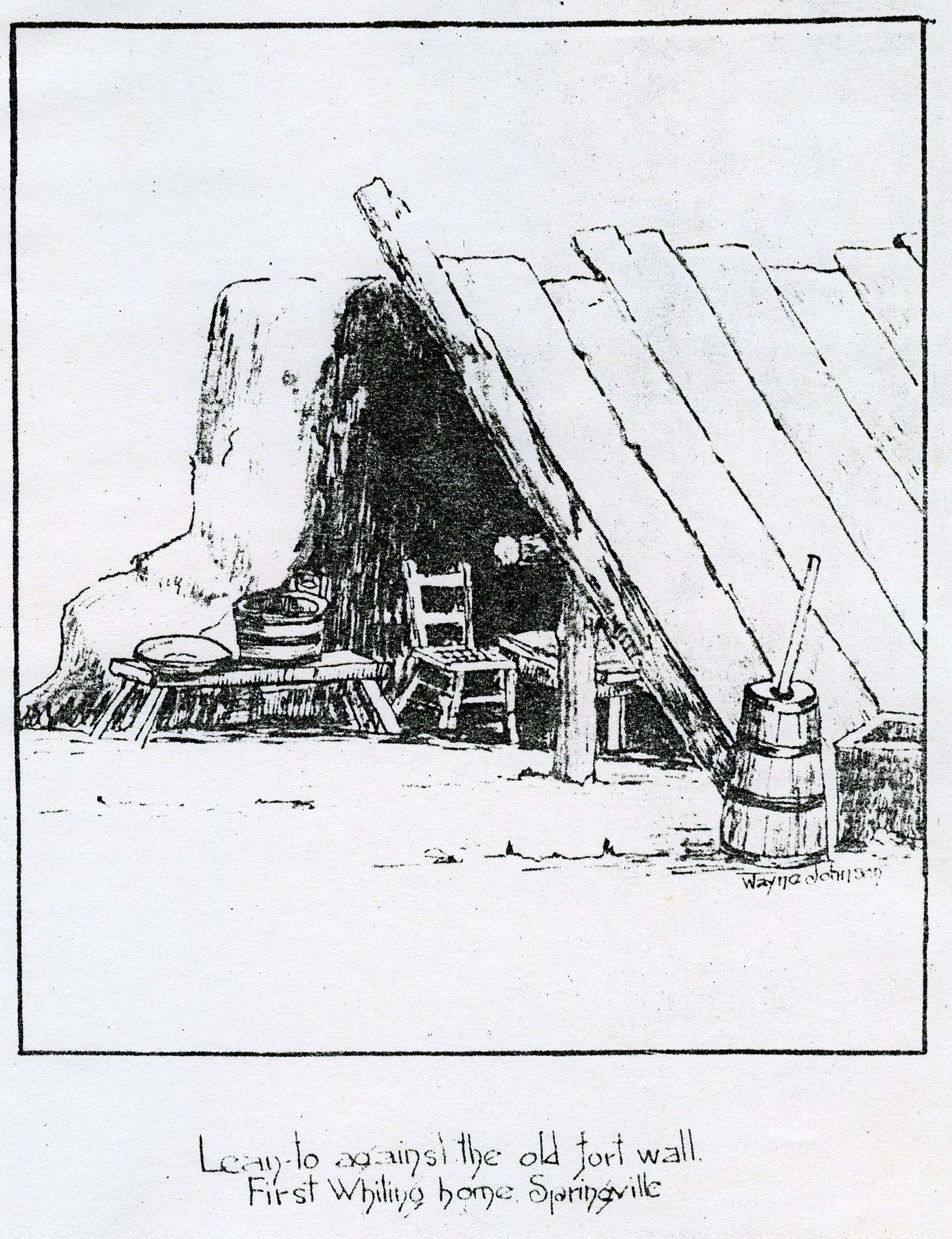
STOP 2: After exiting the cemetery, turn right onto 400 South and travel east for 2 blocks until you reach Main street. Make a right turn on to Main street and travel about 100 feet. On the east side across the street is a large Juniper tree. If parking is available, park on the east side of Main Street in front of this tree. This was the site of the Big House Edwin owned in Springville. As noted, this was not the first place the family lived. Their first dwelling consisted of a simple lean-to inside the walls of the Old Springville Fort, where the family spent their first winter after coming to Springville in 1861. Wayne Johnson, a grandson of Edwin and Elizabeth sketched a drawing of what that first home might have looked like. The location of Edwin’s Lean-to is unknown.
The Lean-To:
Edwin Whiting Springville Property Boundaries:
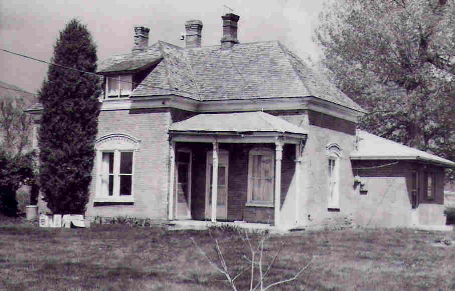
A rough sketch found in the papers of Marie J. Whiting (see modernized sketch below) shows the Edwin Whiting property bordering the south side of 400 South and Main Street in Springville, Utah, extending past 200 East, at least to where his 5th wife, Mary Ann Washburn Whiting lived at about 225 East on 400 South. The property includes the present day Art Museum, where his oldest son, William, also lived on the property. Stephen Chadwick Perry sold him the property and lived south of him. It is not known just how far south Edwin’s property extended, but was called a “strip” of land by Abby, his daughter.
These boundaries are approximate.
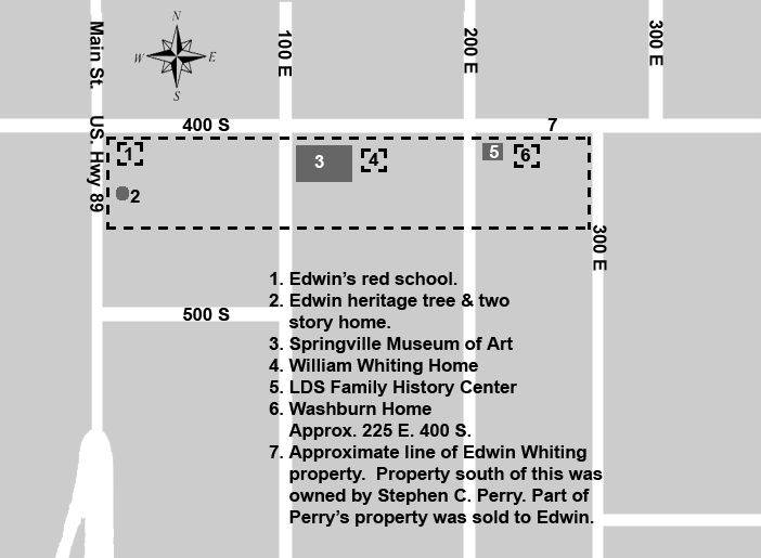
Map of the approximate boundaries of the Edwin Whiting property in Springville, Utah
The Old House:
A transcription of “The Old House” by Abby Ann Whiting Bird
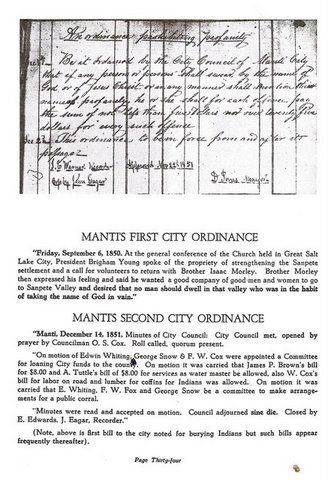
“In 1861, Father Edwin Whitings family were all living in Manti where he had been sent by Brigham Young to organize the San Pitch River. Finding the climate too cold for his occupation as nurseryman, he asked permission of Pres. Young to come north, which was permitted. Father left all his wives and children in Manti except Hannah and her children and moved to Springville. Our home for the first winter was a lean-to by placing boards against the old 12 foot high fort wall. Father bought a strip of land extending from Main street extending to where the High School now stands. (The high school is no longer standing but it was east of the present Art Museum) On this land he soon made homes for the rest of his family. Two homes exactly alike were built of adobe leaving a space of fifty feet between, later filling in this space and joining onto the previously built and we designated it as the Big House, a two story structure with spacious windows and doors, large airy rooms, broad halls and broad steps of native sandstone transported from the quarries of San Pete by ox team by the older sons. Choice fruits and barrie grew in Fathers orchard near the house. These budded from eastern varieties. A school was taught in one of the rooms until a suitable house could be built. There all lived in love and harmony.”
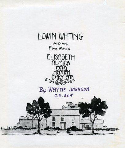
by Abby Ann Whiting Bird, drawing by Wayne Johnson. (Original spelling and punctuation retained.)
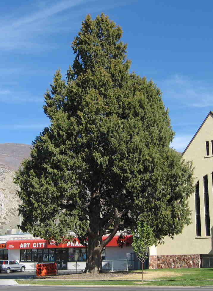
Heritage Tree:
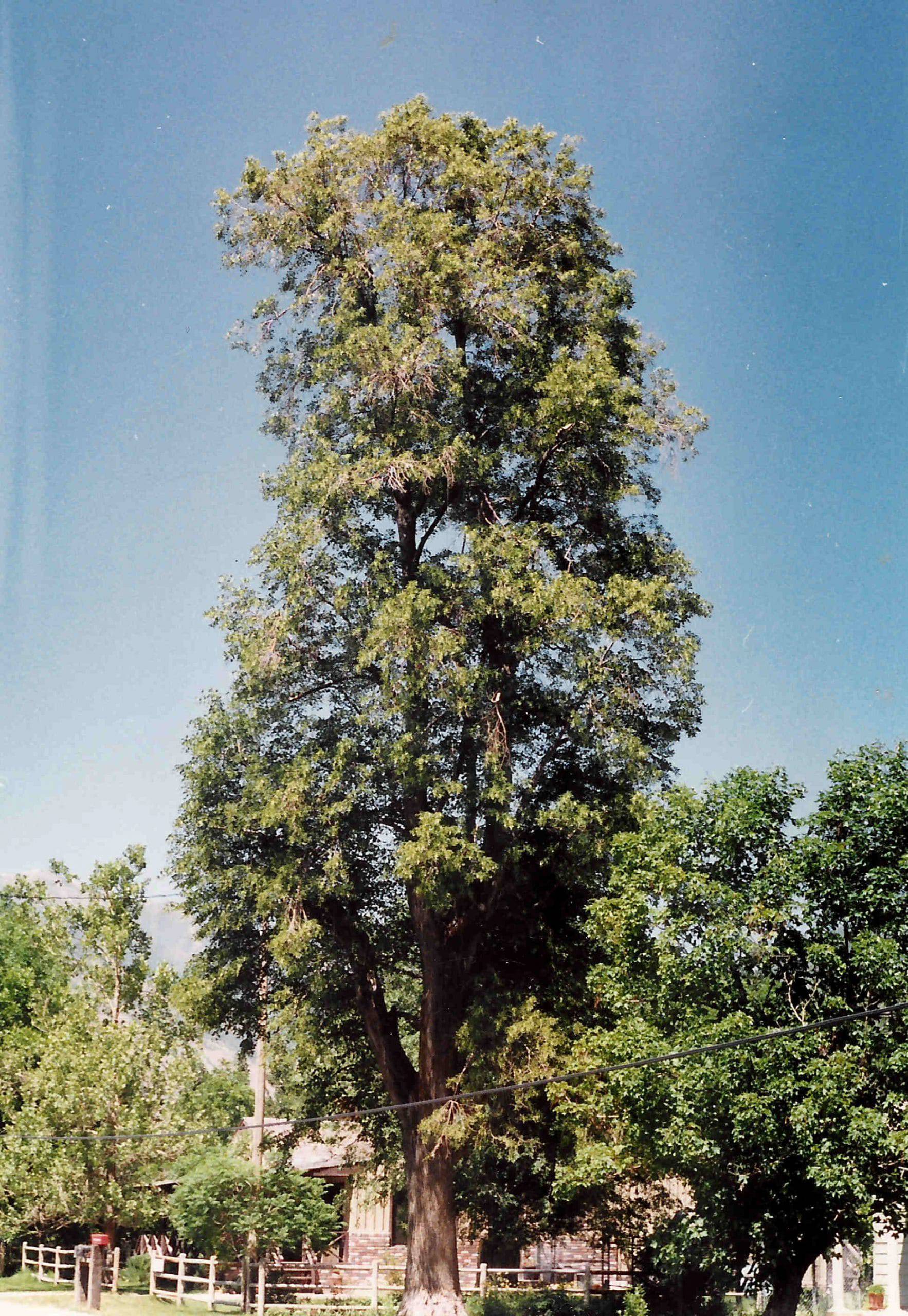
Red Juniper Tree planted on the Edwin Whiting Property:
Family tradition holds that Edwin was responsible for planting several trees throughout the city and Utah County. Many have become diseased or have been removed due to other construction, but one significant specimen still stands at this location, approximately 445 South Main Street. It would likely have been near the front of The Big House. Edwin’s biographers, including his daughters, say that he got many of his trees from the Utah Mountains east of Springville. This tree measures just under 13 feet in circumference and stands about 40 ft. high. It is much bigger than any other Juniper in the area and could have been purchased elsewhere. Other records we have tell us of Edwin purchasing trees in Salt Lake. We are not quite sure where the name “Juniper Red” comes from. Juniper Red is not a Utah Native Tree. There is a plaque at the base of the tree placed by the Daughters of the Pioneers. Several photos over the years show the development of the tree and the changes in the buildings surrounding it.
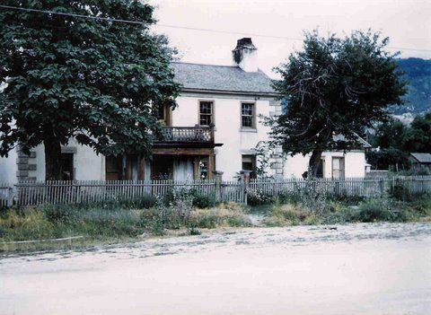
The “Big House” was later demolished and in 1913, the Church of Jesus Christ of Latter-day Saints built a chapel on the property. Extensive remodeling on the historic church building was completed in 1998 (see photo below) and the building was re-dedicated by Gordon B. Hinckley, then president of the Church. The building was extensively damaged by vandals in 2006, who set fire to the structure. It was demolished as a result. The juniper tree still stands (2012).
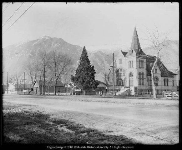
This photograph, from the collections of G. E. Anderson, shows the 2nd Ward building of the Church of Jesus Christ of Latter-day Saints, which stood on the Whiting property after the Big House was demolished. The large Juniper Red cedar tree is still standing, but the building has been demolished and the lot is currently empty (2012).
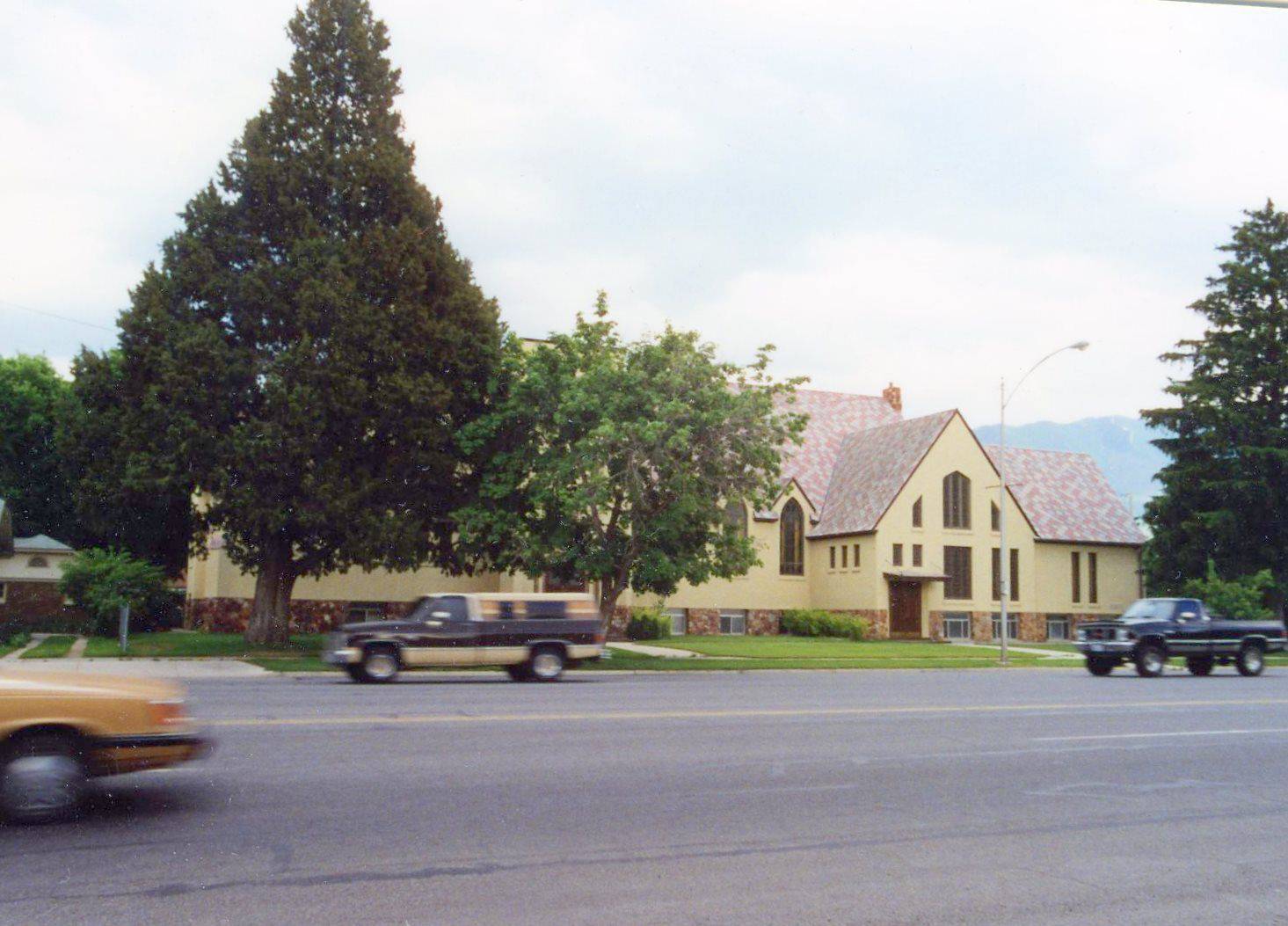
The Second Ward building and the Red Juniper “Heritage Tree” as they appeared in the late 1990s
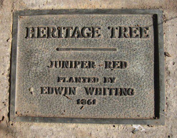
A plaque placed at the foot of the Red Juniper Heritage Tree by the Daughters of the Utah Pioneers during Utah’s Centennial celebration.
Location of Edwin’s Whiting Surprise Birthday Party
The large family dinner held in honor of Edwin’s 79th birthday was photographed on this property. More details about Edwin’s 80th birthday party are available on the website.
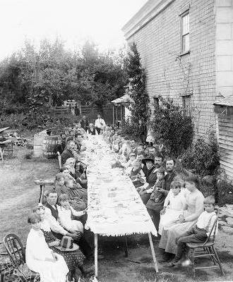
The large family dinner photographed by George Edward Anderson, Springville Photographer. See the details about this event on the page about Edwin’s 79th Birthday Party elsewhere on this website.
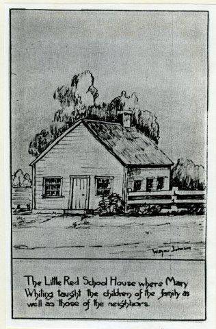
The Little Red School House:
Edwin Whiting’s children and possibly others were taught school in the “Little Red School House” which was originally located on the corner of Main Street and 400 South. A sketch by Grandson, Wayne Johnson, is included here. The Marie Whiting sketch and some of Abby Whiting’s notes refer to the school house. The structure was eventually moved to Mapleton. See the Mapleton Driving Tour notes for more information.
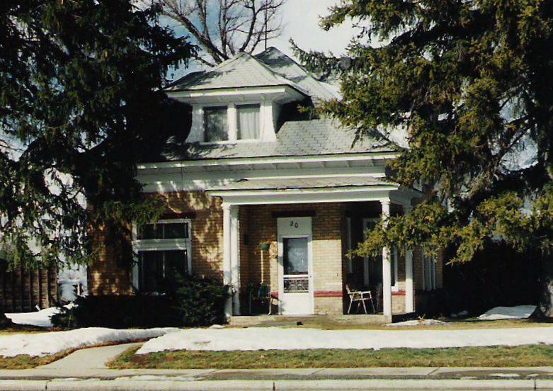
Stop 3: Location of Edwin’s Nursery and the Mary Ann Washburn Home
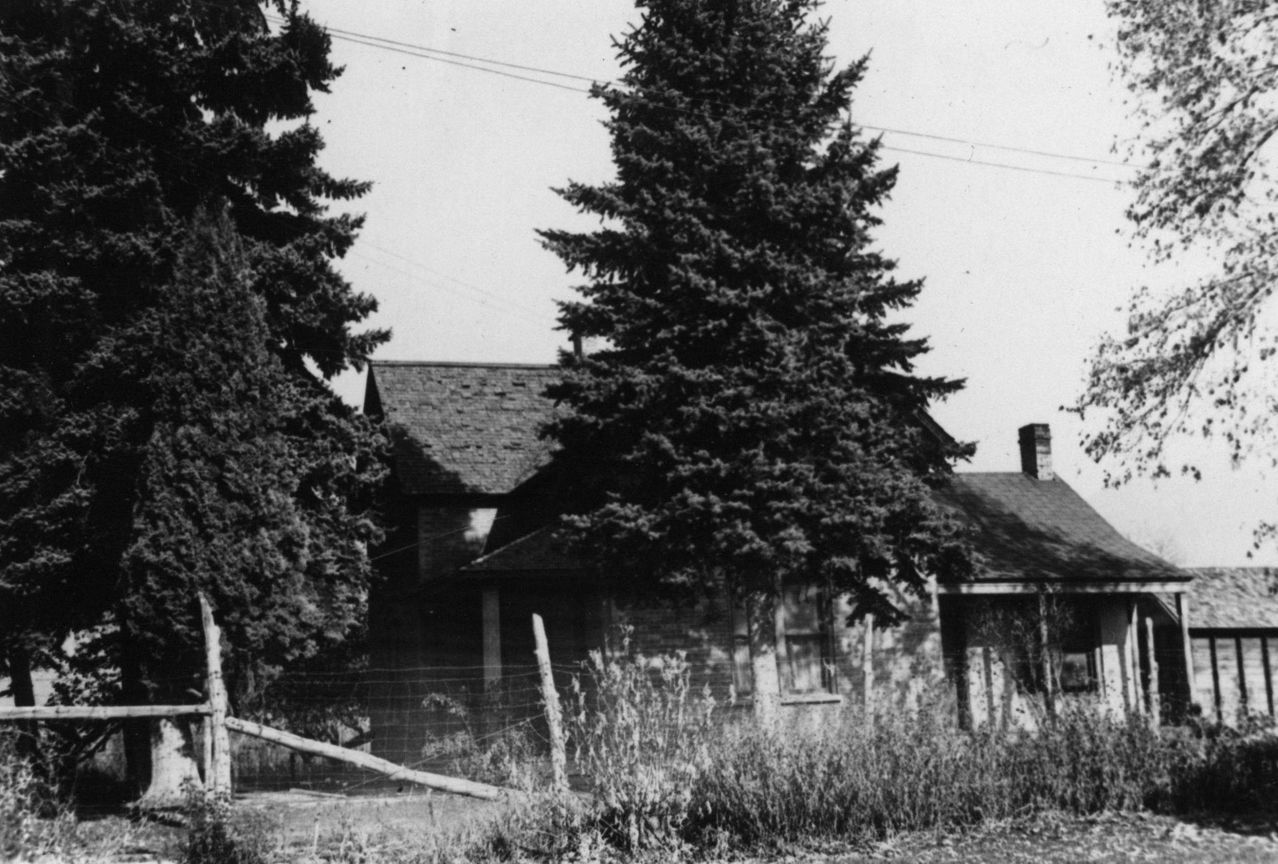
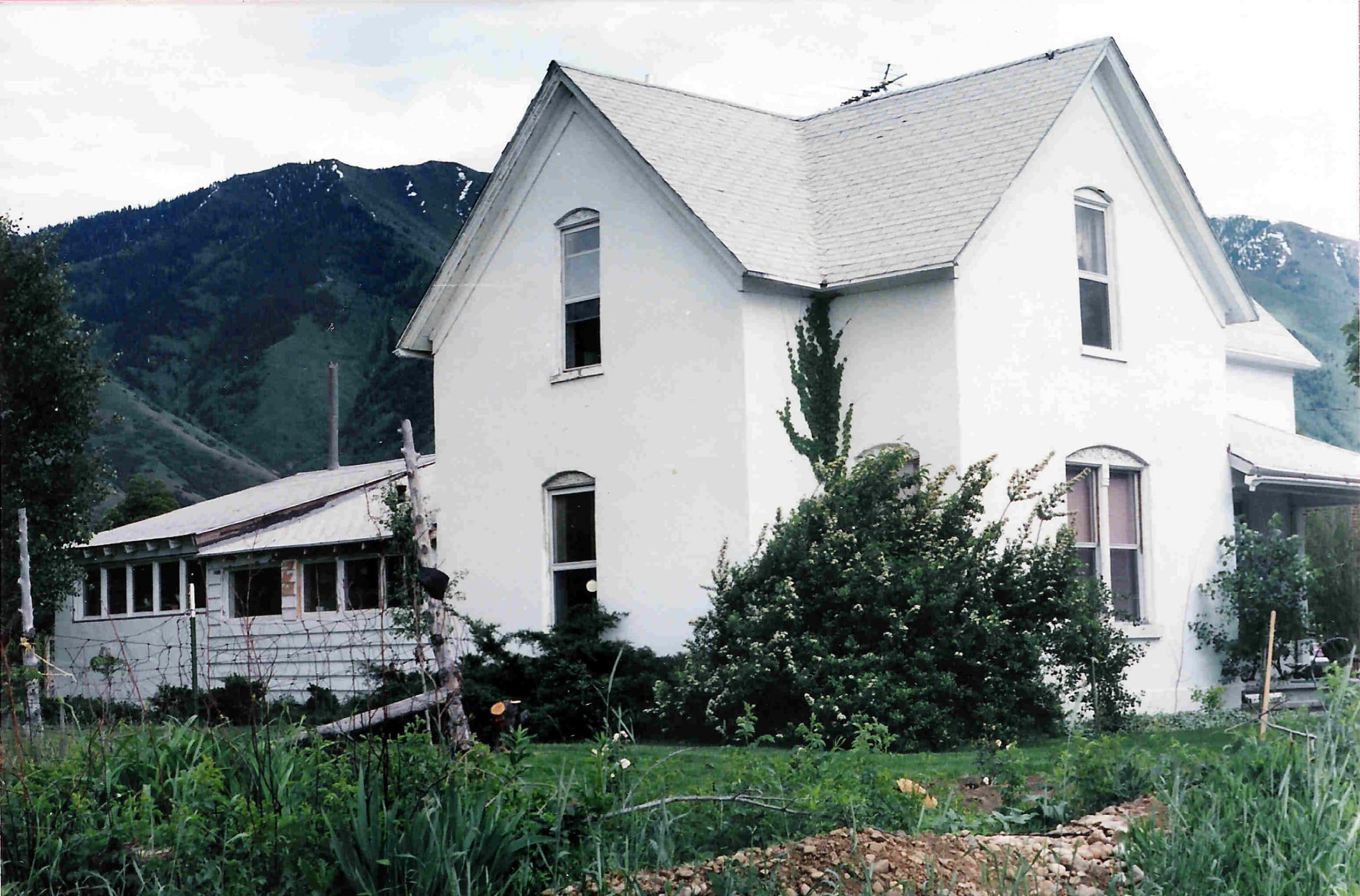
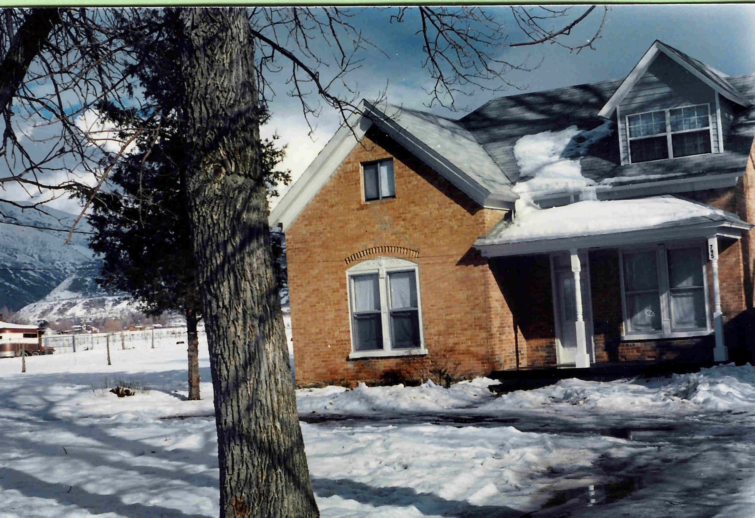
Stop 3. Drive to the parking lot on the east side of the Art Museum at about 170 East on 400 South. Edwin’s Nursery business also included the property now occupied by the Springville Art Museum. The Marie J. Whiting sketch showed the Art Building and William’s Home. William was the oldest child of Edwin and Elizabeth. His story is told elsewhere, but some of the information we have of William tells of a cedar tree by his bedroom window. The cedar tree by the north east corner of the Art Museum is possibly Williams tree. William also planted three American Elm Trees on this property, purchased from a nursery in Salt Lake. His Biography tells about these trees, including a plaque at the base of the last one remaining, which had to be taken down because of disease. The Plaque is now in the DUP Museum in Springville.
The east doors are now the main entrance to the Museum, but the north doors were the main entrance for many years. Still on the north porch are some benches provided by members of the Whiting Family.
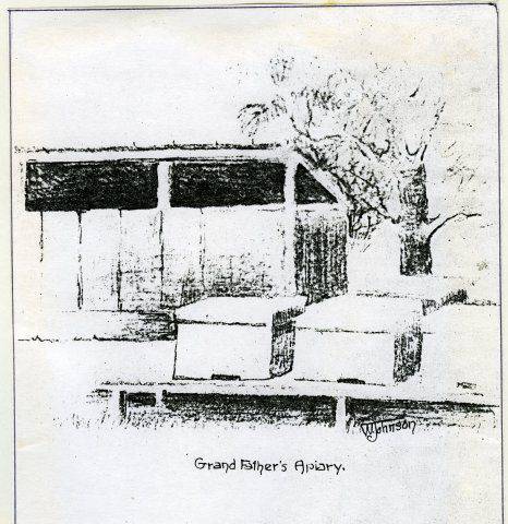
A sketch by Wayne Johnson showing what Edwin’s apiary (beehives) looked like.
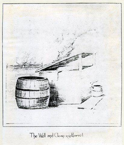
A Wayne Johnson sketch shows “The Well and Cleaning Barrel”. Compare this with the left side of the photo of the Birthday Party above.
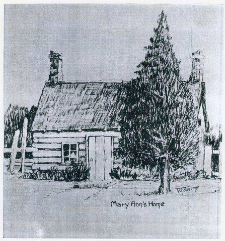
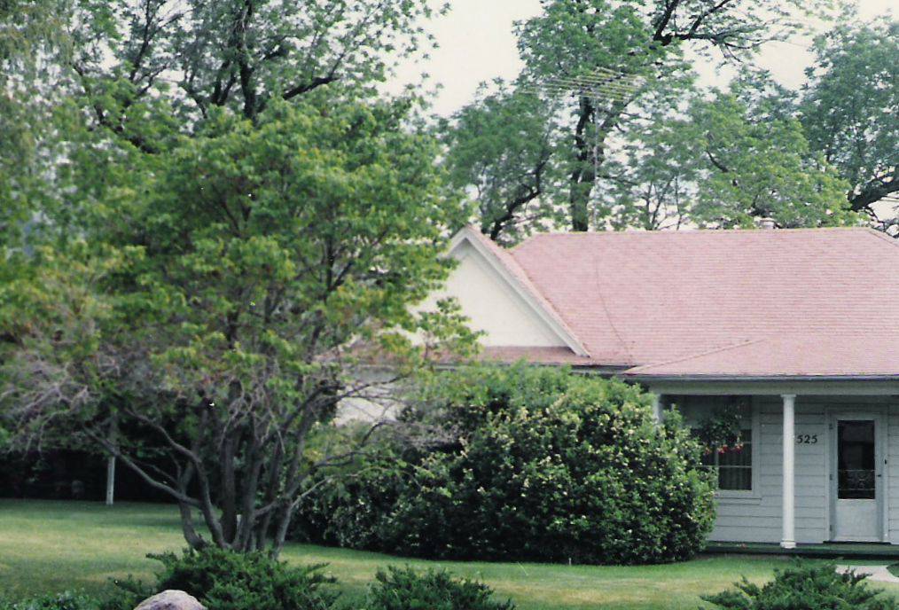
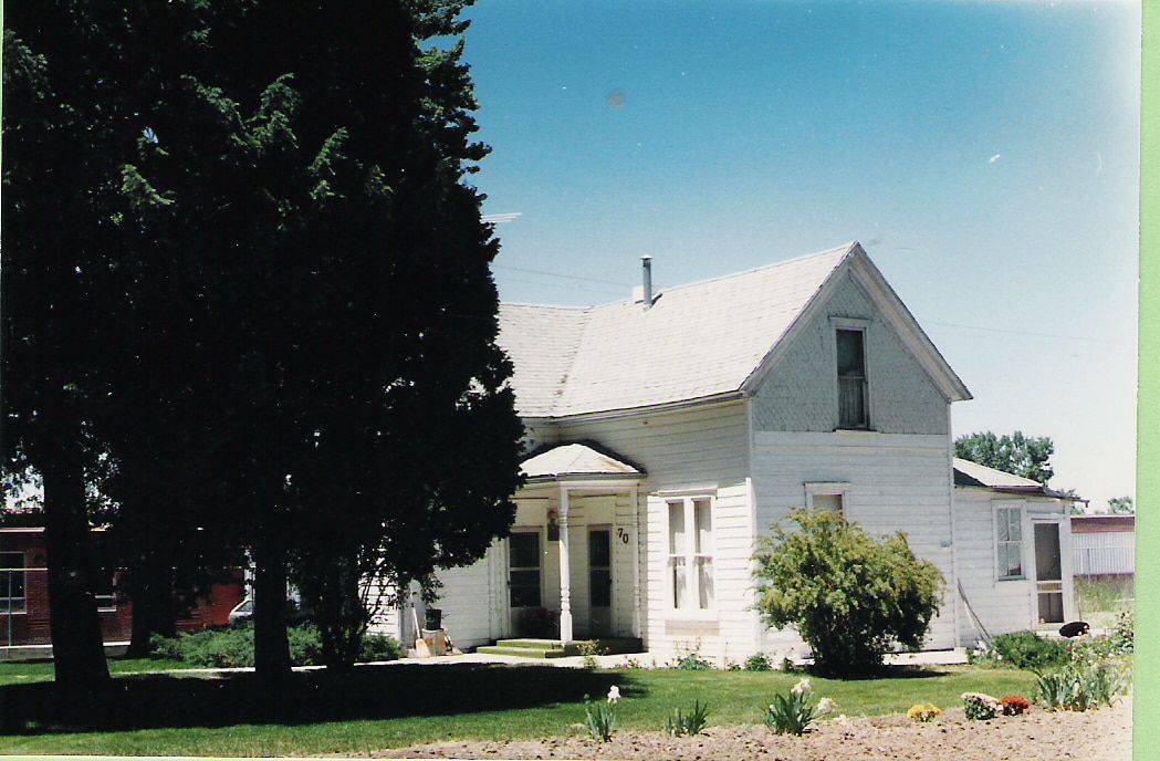
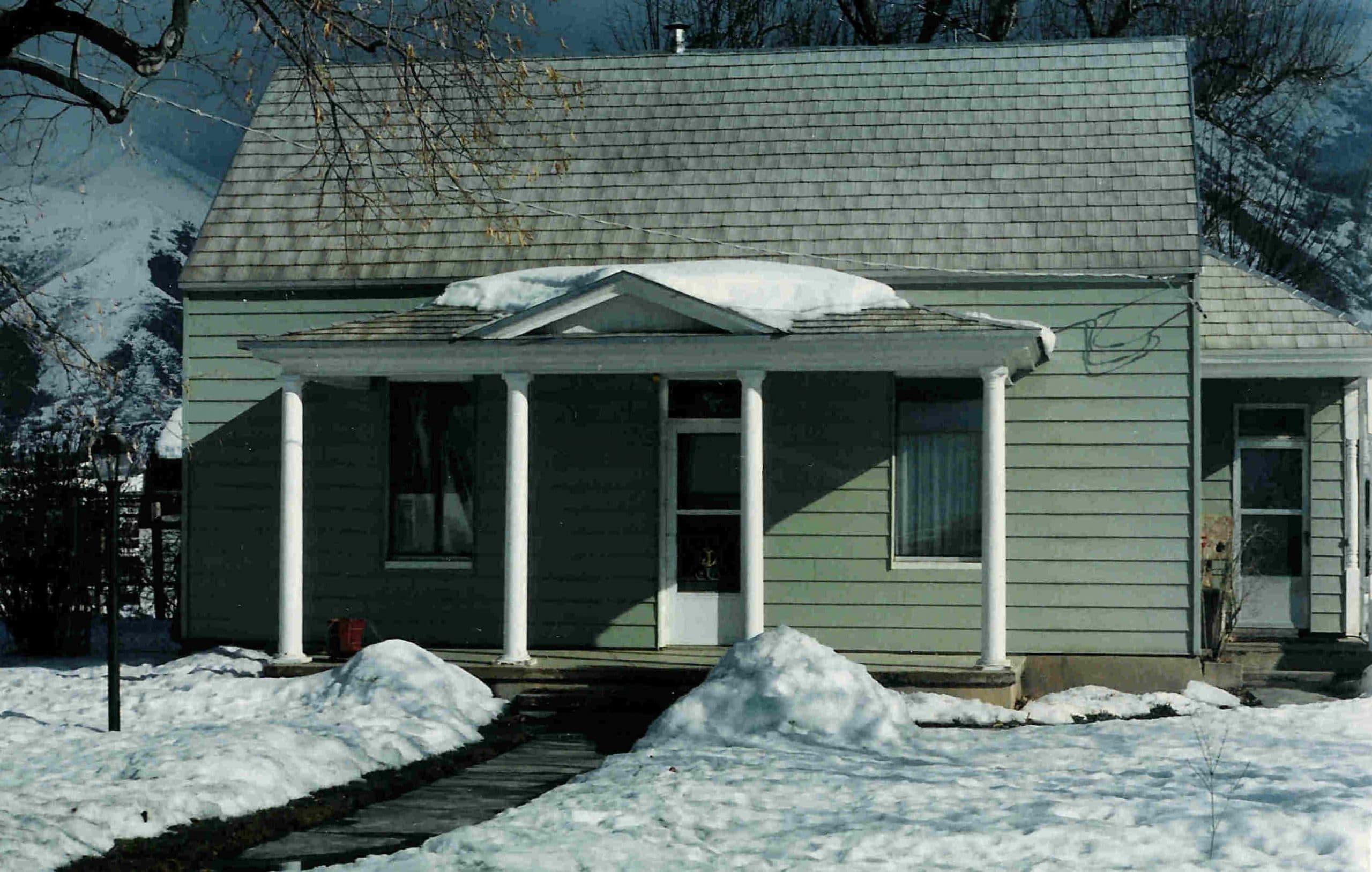
Grandson, Wayne Johnson’s sketch shows the Mary Ann Washburn Home, which was just east of 200 East, according to the Marie Whiting sketch.
At the side of the home at 225 East today is another cedar tree which could have been one of Edwin’s trees also. It looks very close to one at the Art Museum north east corner, which might have been the one that was in font of William Whiting’s bedroom window.
Stop 4: Evergreen Cemetery
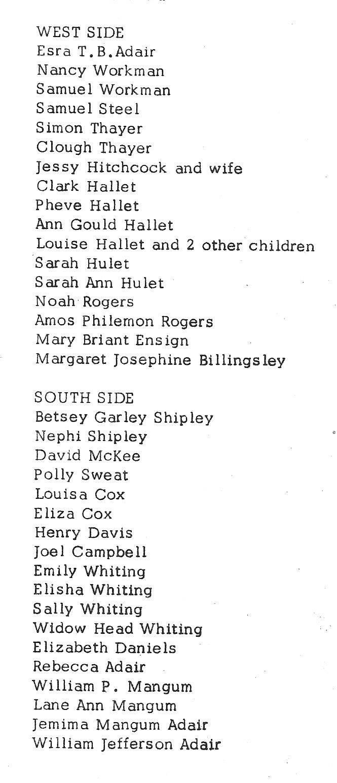
Stop 4. The Springville Evergreen Cemetery Driving instructions: Drive east, toward the mountains to 400 East and turn right. Drive to 1900 South on 400 East to the Springville Evergreen Cemetery. See the following map to identify burial locations of the Edwin Whiting families. The the overall map shown is an older map showing just the older part of the cemetery on the west side of the street, but still covers the gravesites noted below. The reproduction of Section A-D,where you will find the gravesites of those family members that are listed below. Only the first two generations are shown here. Take time and visit their site burial site. For other ancestors, go to http://parks.springville.org/springville-cemeteries.html for a listing of all burial sites.
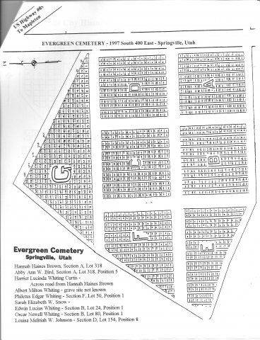
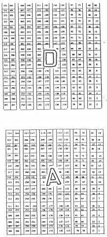
The Edwin Whiting Family Gravesites in the Evergreen Cemetery A and D
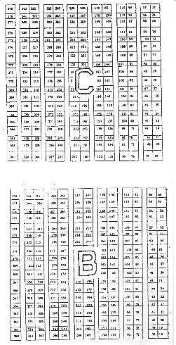
EvergreenCemetery Section B and C
Hannah Haines Brown Whiting, Section A , Lot 318 Pos. 3
Abby Ann Whiting Bird, Section A , Lot 318, Pos. 5
Harriet Lucinda Whiting Curtis, Section B, Lot 26, Pos. 8
Albert Milton Whiting,Section B, Lot 362, pos 4
Sarah Elizabeth Whiting Snow, Section D, Lot 254, Pos 1
Edwin Lucius Whiting, Section B, Lot 24, Position 1
Oscar Newell Whiting, Section B, Lot 80, Position 1
Louisa Melitah Whiting, Johnson, Section D, Lot 154, Position 8
Note: Almira M. Meacham Whiting Packard is burried in the San Bernadino, California Cemetery and Mary Elizabeth Cox is burried in St Johns, Arizona.
To continue on to the Mapleton City driving tour, please click here.

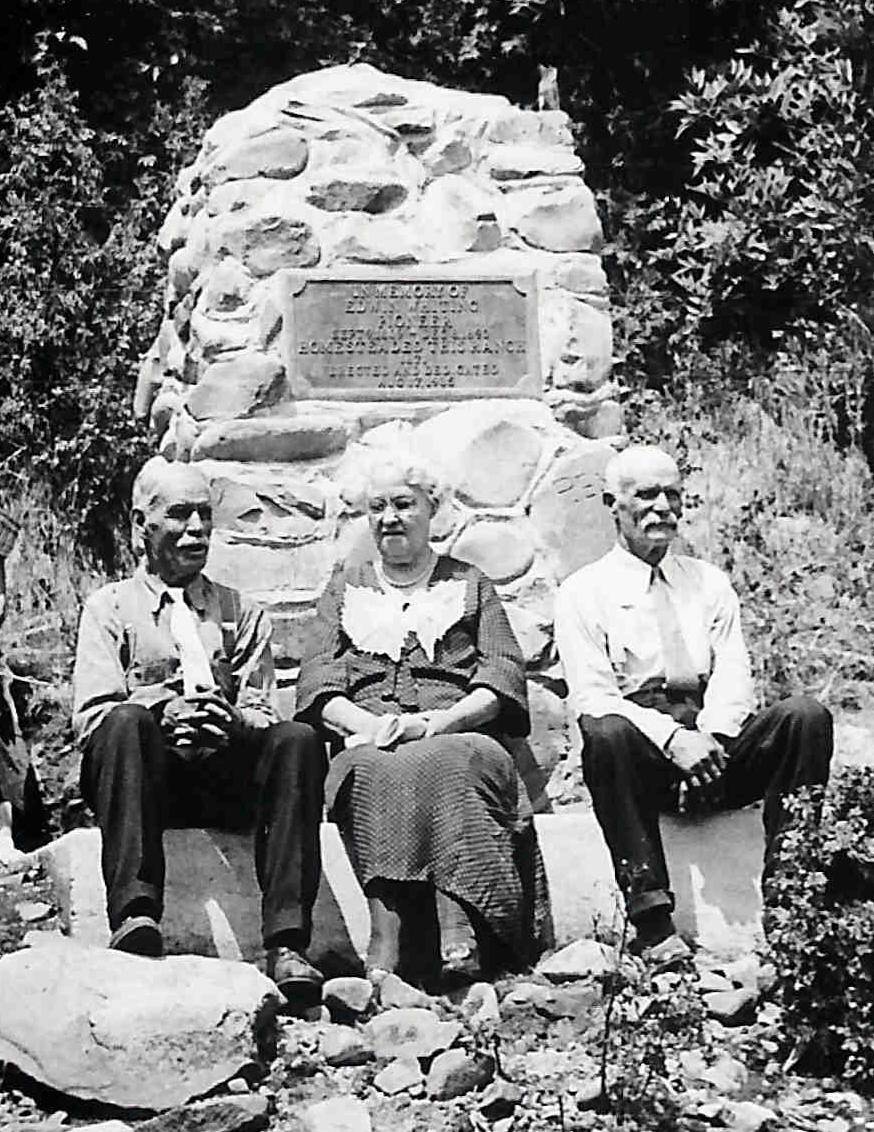 Seen in this photo: The surviving children of Edwin Whiting at the monument dedication, August 17, 1935. From Left to right: Philetus Edgar Whiting- “Uncle Eck:,” Abby Ann Whiting Bird, and John Clarence Whiting.
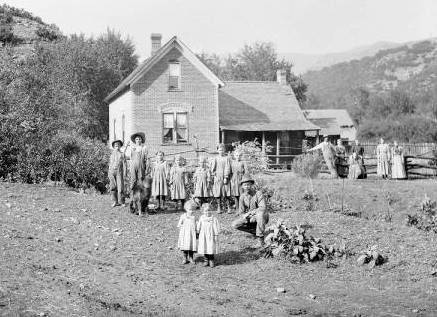 This is the Mary Elizabeth Cox Whiting home in Hobble Creek Canyon. She is seated in a chair front of the fence with three other adults standing behind her. The location of the home was just at the end of the pavement before crossing the bridge. The Sumsion Properties are here now. Philetus Edgar Whiting, a son, is kneeling near the front close to two small girls in the foreground of the photo. Other present are unknown. The home is no longer standing.
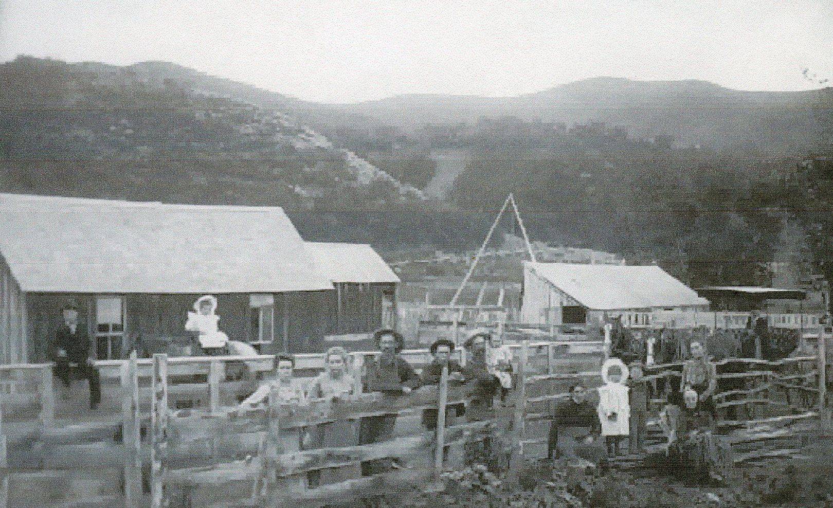
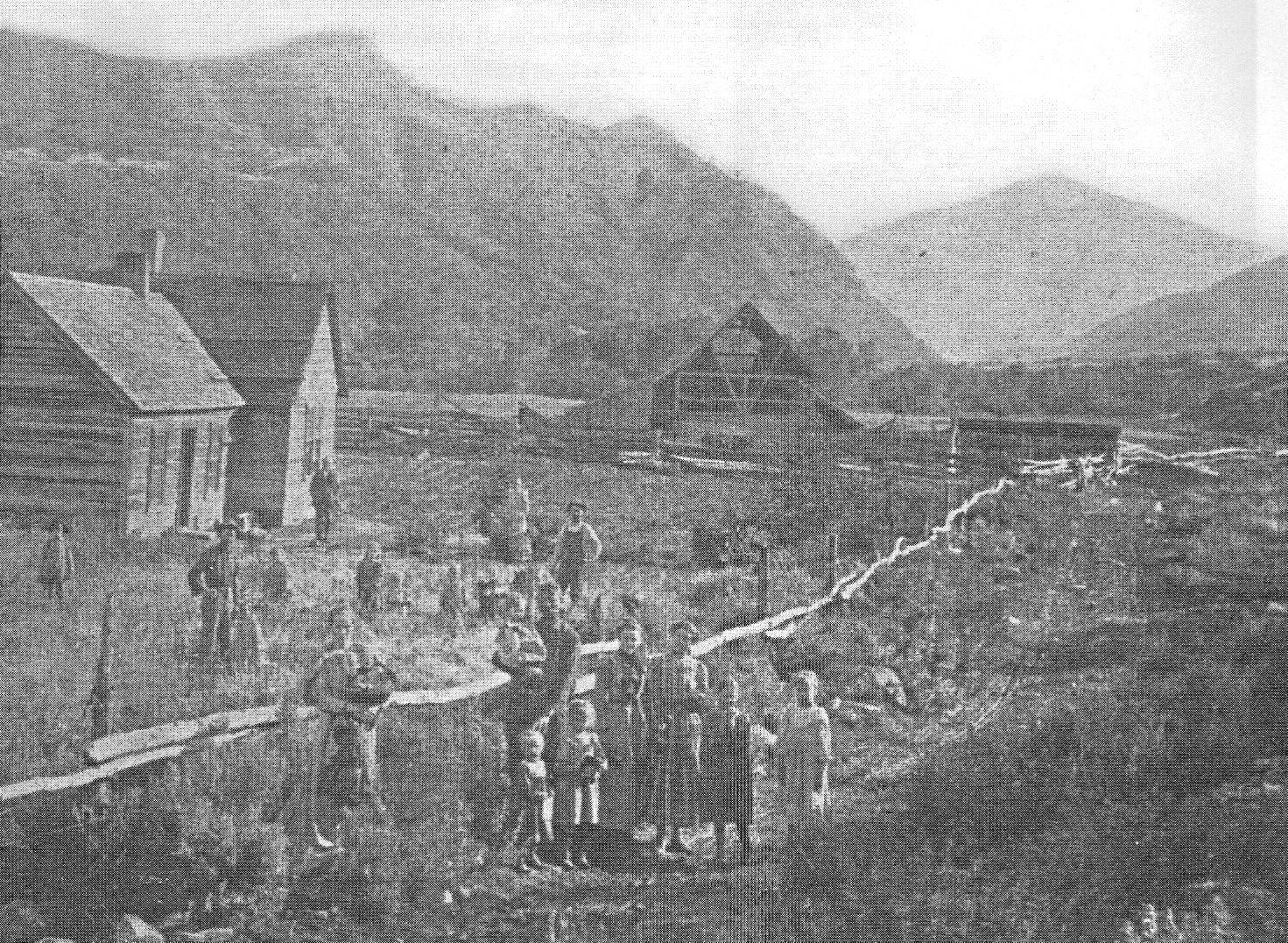
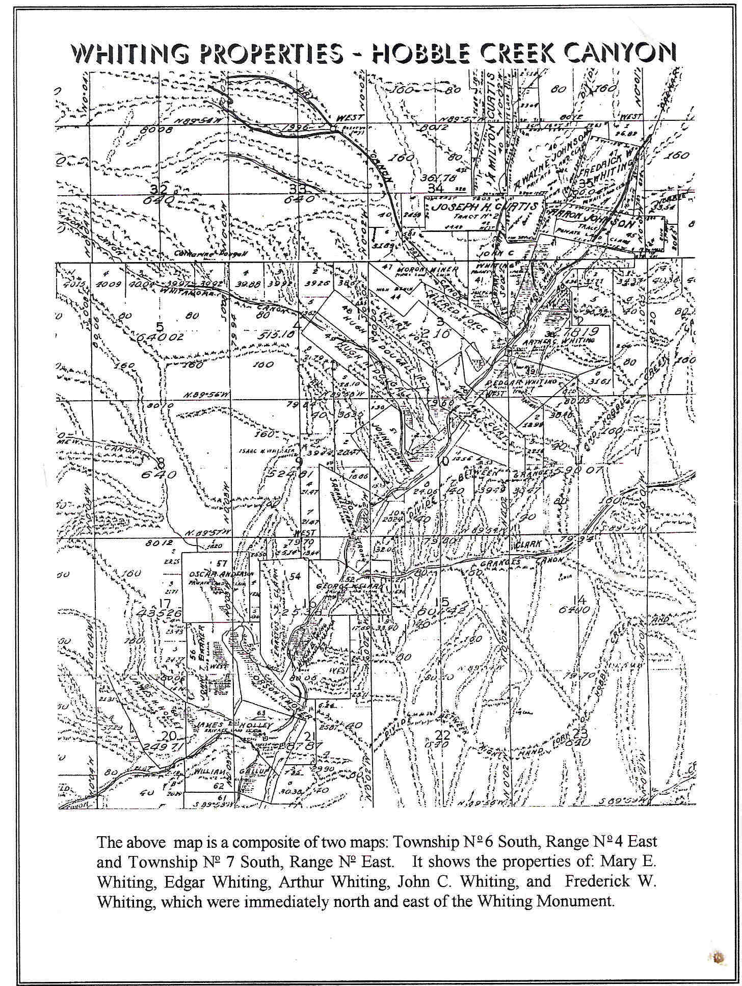 Early Map of Hobble Creek Canyon, Left Hand Fork, Showing Whiting Properties On the map look for the name Whiting in the upper right hand part of the map. You will see Arthur Whiting, P. Edgar Whiting, John C. Whiting, Mary E. Whiting, Fredrick W. Whiting, Joseph H. Curtis (husband of Harriet Lucinda Whiting). This property is all near the end of the paved road and bridge (in 2012) and just beyond the Edwin Whiting Monument. (Enlarge this image to see names better using Control + on your keyboard)
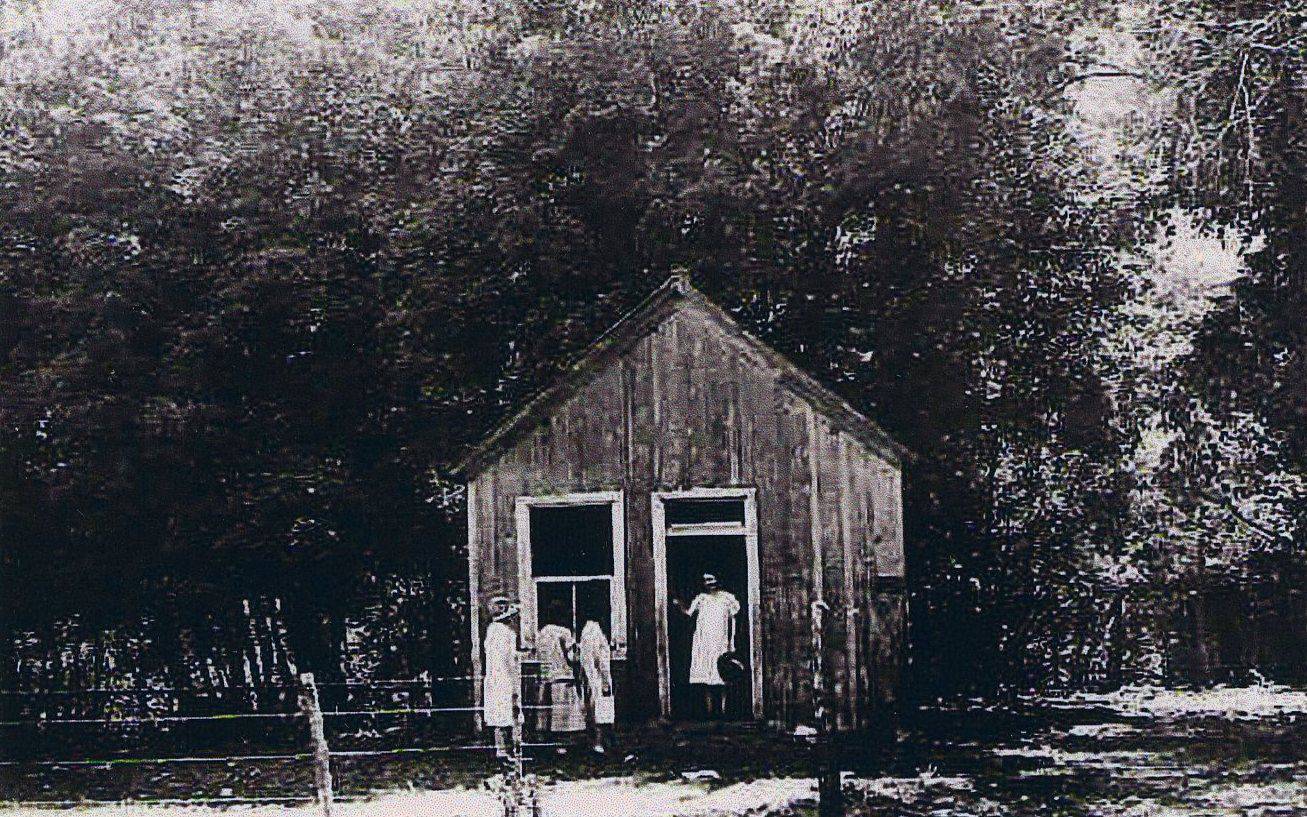
 Mary Cox Little Red School House Moved from Springville by Ox Team
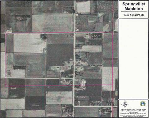


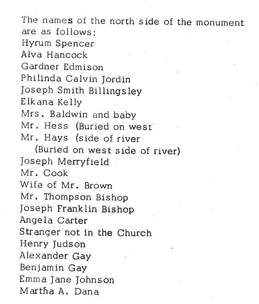
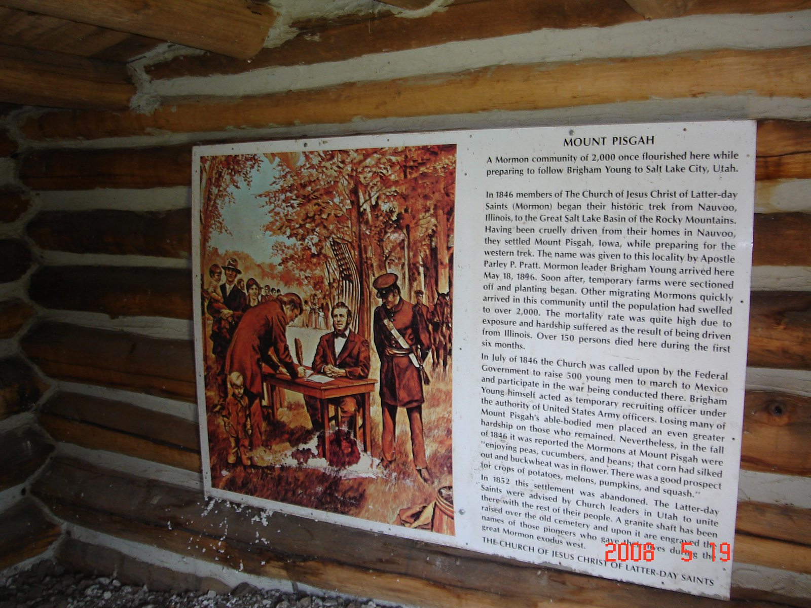
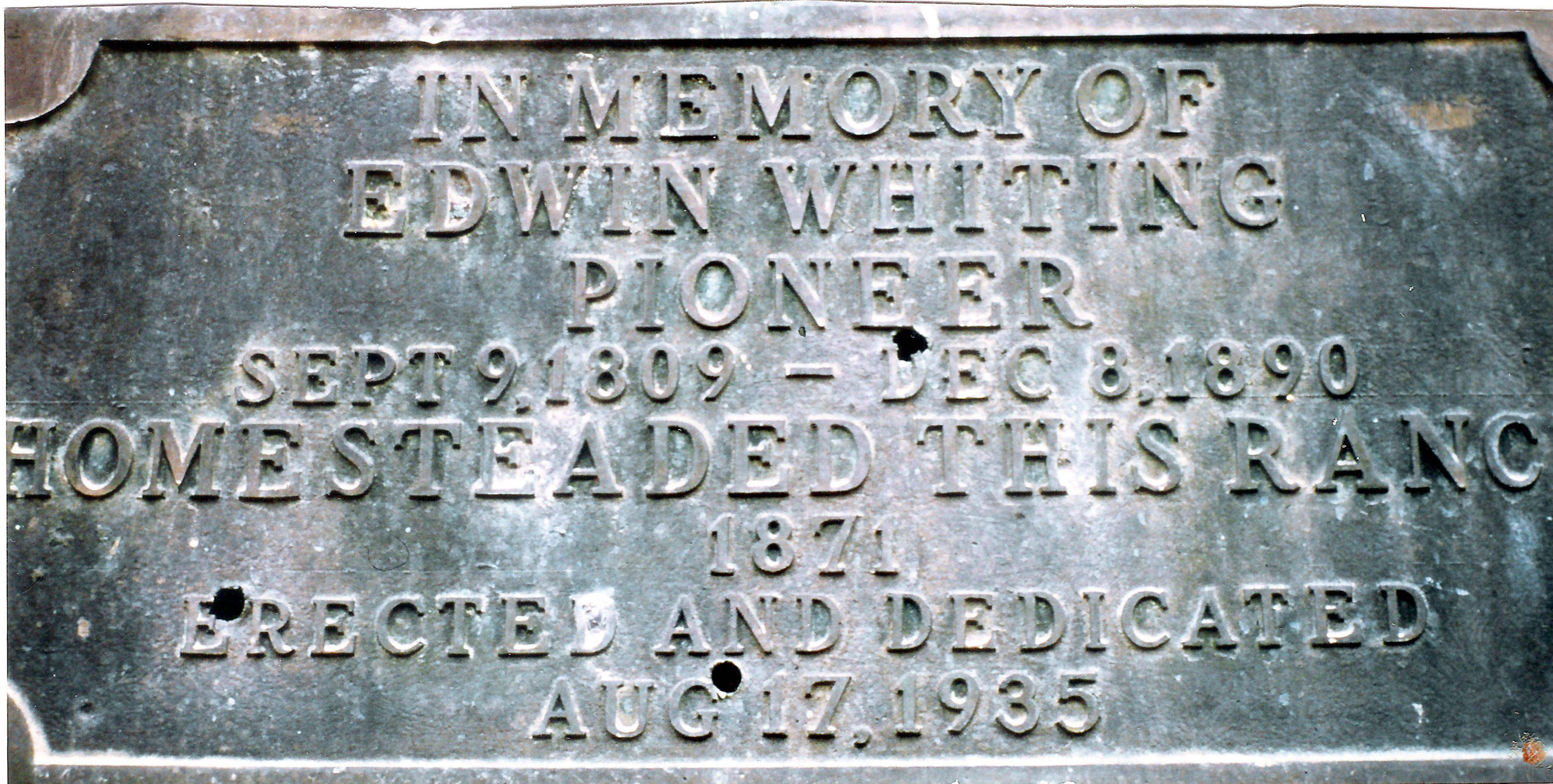
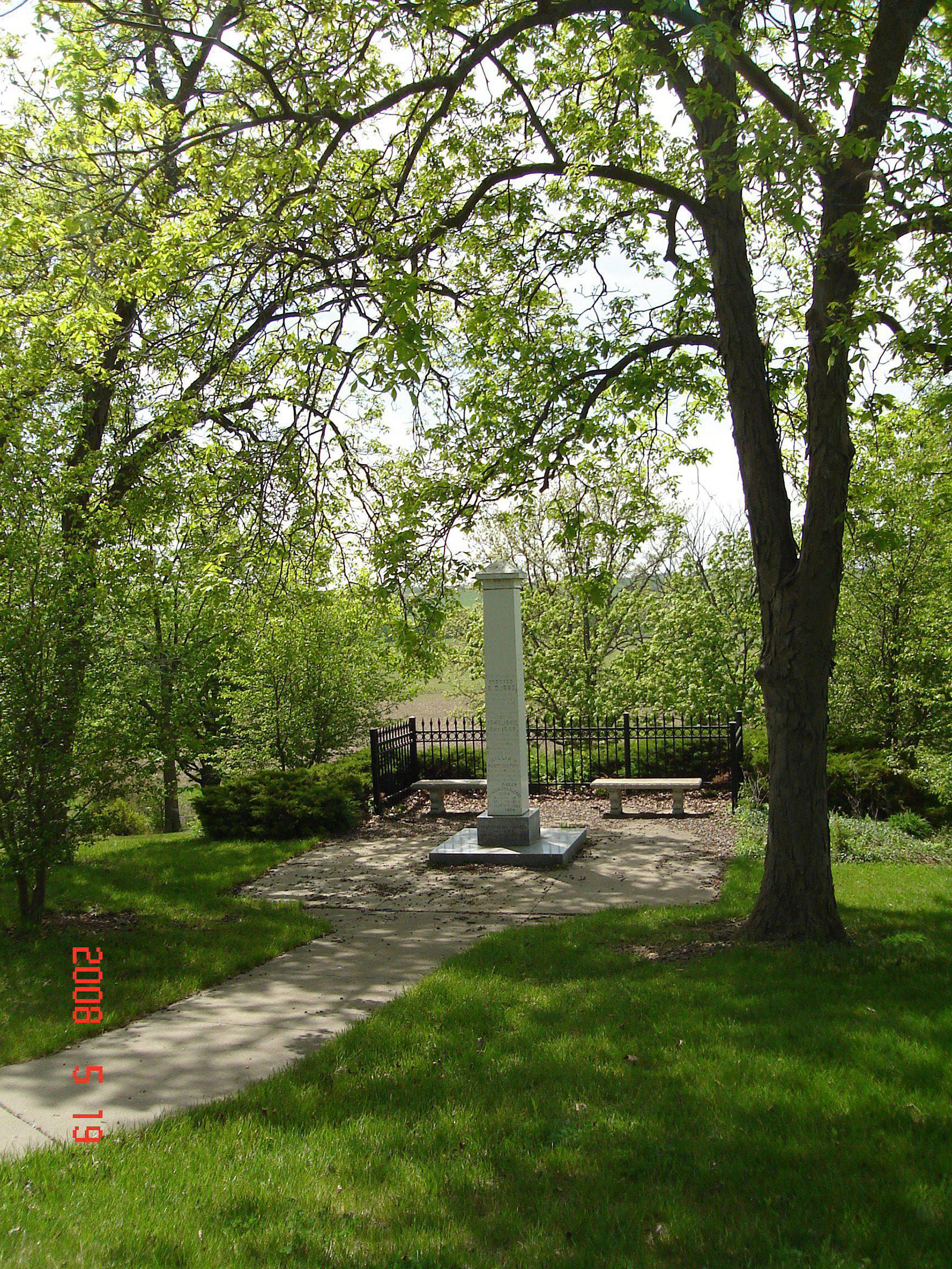 Monument at Mt. Pisgah which includes the names of those who perished here.